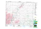
Maps showing Lambton Park, 26-52-24-W4, Alberta
Lambton Park is a Unincorporated area located in 26-52-24-W4, Alberta and has an elevation of 668 meters.
- Latitude: 53° 31' North (decimal: 53.5166999)
- Longitude: 113° 25' West (decimal: -113.4167000)
- Topography Feature Category: Unincorporated area
- Geographical Feature: Railway Point
- Canadian Province/Territory: Alberta
- Elevation: 668 meters
- Location: 26-52-24-W4
- Atlas of Canada Locator Map: Lambton Park
- GPS Coordinate Locator Map: Lambton Park Lat/Long