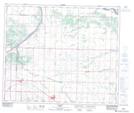
Maps showing Lamont, 55-19-W4, Alberta
Lamont is a Town located in 55-19-W4, Alberta and has an elevation of 649 meters.
- Latitude: 53° 45' 33'' North (decimal: 53.7591666)
- Longitude: 112° 47' 4'' West (decimal: -112.7844443)
- Topography Feature Category: Town
- Geographical Feature: Town
- Canadian Province/Territory: Alberta
- Elevation: 649 meters
- Location: 55-19-W4
- Atlas of Canada Locator Map: Lamont
- GPS Coordinate Locator Map: Lamont Lat/Long