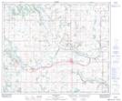
Maps showing Lang Lake, 29-50-10-W4, Alberta
Lang Lake is a Lake located in 29-50-10-W4, Alberta and has an elevation of 647 meters.
- Latitude: 53° 20' 22'' North (decimal: 53.3394444)
- Longitude: 111° 25' 12'' West (decimal: -111.4200000)
- Topography Feature Category: Lake
- Geographical Feature: Lake
- Canadian Province/Territory: Alberta
- Elevation: 647 meters
- Location: 29-50-10-W4
- Atlas of Canada Locator Map: Lang Lake
- GPS Coordinate Locator Map: Lang Lake Lat/Long
Lang Lake NTS Map Sheets