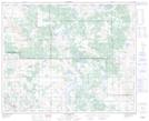
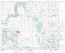
Maps showing Arm Lake, 36-43-5-W4, Alberta
Arm Lake is a Lake located in 36-43-5-W4, Alberta and has an elevation of 673 meters.
- Latitude: 52° 44' 47'' North (decimal: 52.7463889)
- Longitude: 110° 35' 58'' West (decimal: -110.5994444)
- Topography Feature Category: Lake
- Geographical Feature: Lake
- Canadian Province/Territory: Alberta
- Elevation: 673 meters
- Location: 36-43-5-W4
- Atlas of Canada Locator Map: Arm Lake
- GPS Coordinate Locator Map: Arm Lake Lat/Long
Arm Lake NTS Map Sheets