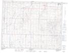
Maps showing Arrowwood, 32-20-23-W4, Alberta
Arrowwood is a Village located in 32-20-23-W4, Alberta and has an elevation of 931 meters.
- Latitude: 50° 44' 22'' North (decimal: 50.7394443)
- Longitude: 113° 8' 54'' West (decimal: -113.1483331)
- Topography Feature Category: Village
- Geographical Feature: Village
- Canadian Province/Territory: Alberta
- Elevation: 931 meters
- Location: 32-20-23-W4
- Atlas of Canada Locator Map: Arrowwood
- GPS Coordinate Locator Map: Arrowwood Lat/Long