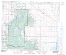
Maps showing Astotin Creek, 20-56-20-W4, Alberta
Astotin Creek is a River located in 20-56-20-W4, Alberta and has an elevation of 650 meters.
- Latitude: 53° 51' 11'' North (decimal: 53.8530555)
- Longitude: 112° 56' 29'' West (decimal: -112.9413888)
- Topography Feature Category: River
- Geographical Feature: Creek
- Canadian Province/Territory: Alberta
- Elevation: 650 meters
- Location: 20-56-20-W4
- Atlas of Canada Locator Map: Astotin Creek
- GPS Coordinate Locator Map: Astotin Creek Lat/Long
Astotin Creek NTS Map Sheets