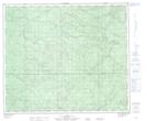
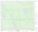
Maps showing Atikkamek Creek, 65-19-W5, Alberta
Atikkamek Creek is a River located in 65-19-W5, Alberta and has an elevation of 738 meters.
- Latitude: 54° 36' 24'' North (decimal: 54.6066666)
- Longitude: 116° 51' 12'' West (decimal: -116.8533333)
- Topography Feature Category: River
- Geographical Feature: Creek
- Canadian Province/Territory: Alberta
- Elevation: 738 meters
- Location: 65-19-W5
- Atlas of Canada Locator Map: Atikkamek Creek
- GPS Coordinate Locator Map: Atikkamek Creek Lat/Long
Atikkamek Creek NTS Map Sheets