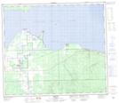
Maps showing Auger Bay, 74-8,9-W5, Alberta
Auger Bay is a Bay located in 74-8,9-W5, Alberta and has an elevation of 564 meters.
- Latitude: 55° 23' 58'' North (decimal: 55.3994444)
- Longitude: 115° 15' 12'' West (decimal: -115.2533332)
- Topography Feature Category: Bay
- Geographical Feature: Bay
- Canadian Province/Territory: Alberta
- Elevation: 564 meters
- Location: 74-8,9-W5
- Atlas of Canada Locator Map: Auger Bay
- GPS Coordinate Locator Map: Auger Bay Lat/Long
Auger Bay NTS Map Sheets