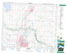
Maps showing Prentiss, 24-39-26-W4, Alberta
Prentiss is a Unincorporated area located in 24-39-26-W4, Alberta and has an elevation of 911 meters.
- Latitude: 52° 22' 29'' North (decimal: 52.3747222)
- Longitude: 113° 37' 13'' West (decimal: -113.6202777)
- Topography Feature Category: Unincorporated area
- Geographical Feature: Locality
- Canadian Province/Territory: Alberta
- Elevation: 911 meters
- Location: 24-39-26-W4
- Atlas of Canada Locator Map: Prentiss
- GPS Coordinate Locator Map: Prentiss Lat/Long