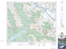
Maps showing Edward Peak, 34-22-W5, Alberta
Edward Peak is a Mountain located in 34-22-W5, Alberta and has an elevation of 3275 meters.
- Latitude: 51° 57' 34'' North (decimal: 51.9594444)
- Longitude: 117° 5' 42'' West (decimal: -117.0950000)
- Topography Feature Category: Mountain
- Geographical Feature: Peak
- Canadian Province/Territory: Alberta
- Elevation: 3275 meters
- Location: 34-22-W5
- Atlas of Canada Locator Map: Edward Peak
- GPS Coordinate Locator Map: Edward Peak Lat/Long
Edward Peak NTS Map Sheets