Canada Topographic Maps

St. Paul des Métis Topo Maps

Topography maps and Latitude/Longitude Location

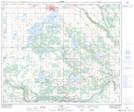
Maps showing St. Paul des Métis, Alberta

St. Paul des Métis is a Town located in Alberta.

  • Latitude: 53° 59' North   (decimal: 53.9833000)
  • Longitude: 111° 17' West   (decimal: -111.2833000)
  • Topography Feature Category: Town
  • Geographical Feature: Town
  • Canadian Province/Territory: Alberta
  • GPS Coordinate Locator Map: St. Paul des Métis Lat/Long

St. Paul des Métis NTS Map Sheets

073E14 St Paul Topographic Map at 1:50,000 scale

073E Vermilion Topographic Map at 1:250,000 scale

 
Buy Topographic Maps DVD
Newsletter Sign-up

Yes, I want to receive map store discounts.


Bookmark and Share