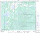
Maps showing Elizabeth Metis Settlement, 59-1-W4, Alberta
Elizabeth Metis Settlement is a Unincorporated area located in 59-1-W4, Alberta.
- Latitude: 54° 7' North (decimal: 54.1166667)
- Longitude: 110° 5' West (decimal: -110.0833333)
- Topography Feature Category: Unincorporated area
- Geographical Feature: Metis Settlement
- Canadian Province/Territory: Alberta
- Location: 59-1-W4
- Atlas of Canada Locator Map: Elizabeth Metis Settlement
- GPS Coordinate Locator Map: Elizabeth Metis Settlement Lat/Long
Elizabeth Metis Settlement NTS Map Sheets