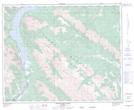
Maps showing Elliott Peak, 36-18-W5, Alberta
Elliott Peak is a Mountain located in 36-18-W5, Alberta and has an elevation of 2509 meters.
- Latitude: 52° 7' 41'' North (decimal: 52.1280555)
- Longitude: 116° 28' 30'' West (decimal: -116.4750000)
- Topography Feature Category: Mountain
- Geographical Feature: Peak
- Canadian Province/Territory: Alberta
- Elevation: 2509 meters
- Location: 36-18-W5
- Atlas of Canada Locator Map: Elliott Peak
- GPS Coordinate Locator Map: Elliott Peak Lat/Long
Elliott Peak NTS Map Sheets