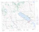
Maps showing Elspeth, 33-38-2-W5, Alberta
Elspeth is a Unincorporated area located in 33-38-2-W5, Alberta and has an elevation of 993 meters.
- Latitude: 52° 18' 28'' North (decimal: 52.3077777)
- Longitude: 114° 13' 14'' West (decimal: -114.2205555)
- Topography Feature Category: Unincorporated area
- Geographical Feature: Locality
- Canadian Province/Territory: Alberta
- Elevation: 993 meters
- Location: 33-38-2-W5
- Atlas of Canada Locator Map: Elspeth
- GPS Coordinate Locator Map: Elspeth Lat/Long
Elspeth NTS Map Sheets