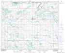
Maps showing Lac Emilien, 53-8-W4, Alberta
Lac Emilien is a Lake located in 53-8-W4, Alberta and has an elevation of 671 meters.
- Latitude: 53° 32' 45'' North (decimal: 53.5458332)
- Longitude: 111° 7' 22'' West (decimal: -111.1227778)
- Topography Feature Category: Lake
- Geographical Feature: Lac
- Canadian Province/Territory: Alberta
- Elevation: 671 meters
- Location: 53-8-W4
- Atlas of Canada Locator Map: Lac Emilien
- GPS Coordinate Locator Map: Lac Emilien Lat/Long