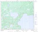
Maps showing English Bay, 21-64-2-W4, Alberta
English Bay is a Bay located in 21-64-2-W4, Alberta and has an elevation of 546 meters.
- Latitude: 54° 33' 5'' North (decimal: 54.5513889)
- Longitude: 110° 13' 45'' West (decimal: -110.2291667)
- Topography Feature Category: Bay
- Geographical Feature: Bay
- Canadian Province/Territory: Alberta
- Elevation: 546 meters
- Location: 21-64-2-W4
- Atlas of Canada Locator Map: English Bay
- GPS Coordinate Locator Map: English Bay Lat/Long
English Bay NTS Map Sheets