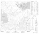
Maps showing English Island, 112-7-W4, Alberta
English Island is a Island located in 112-7-W4, Alberta and has an elevation of 226 meters.
- Latitude: 58° 42' 9'' North (decimal: 58.7024999)
- Longitude: 111° 10' 15'' West (decimal: -111.1708332)
- Topography Feature Category: Island
- Geographical Feature: Island
- Canadian Province/Territory: Alberta
- Elevation: 226 meters
- Location: 112-7-W4
- Atlas of Canada Locator Map: English Island
- GPS Coordinate Locator Map: English Island Lat/Long
English Island NTS Map Sheets