Maps showing Erickson Lake, 63,64-6-W5, Alberta
Erickson Lake is a Lake located in 63,64-6-W5, Alberta and has an elevation of 738 meters.
- Latitude: 54° 30' 4'' North (decimal: 54.5011110)
- Longitude: 114° 46' 27'' West (decimal: -114.7741666)
- Topography Feature Category: Lake
- Geographical Feature: Lake
- Canadian Province/Territory: Alberta
- Elevation: 738 meters
- Location: 63,64-6-W5
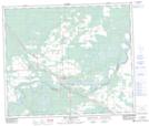
- Atlas of Canada Locator Map: Erickson Lake
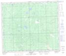
- GPS Coordinate Locator Map: Erickson Lake Lat/Long
Erickson Lake NTS Map Sheets