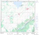
Maps showing Last Lake, 25-83-26-W5, Alberta
Last Lake is a Unincorporated area located in 25-83-26-W5, Alberta and has an elevation of 672 meters.
- Latitude: 56° 13' 6'' North (decimal: 56.2183332)
- Longitude: 117° 58' 45'' West (decimal: -117.9791666)
- Topography Feature Category: Unincorporated area
- Geographical Feature: Locality
- Canadian Province/Territory: Alberta
- Elevation: 672 meters
- Location: 25-83-26-W5
- Atlas of Canada Locator Map: Last Lake
- GPS Coordinate Locator Map: Last Lake Lat/Long
Last Lake NTS Map Sheets