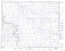
Maps showing Lathom Lake, 21,28-20-17-W4, Alberta
Lathom Lake is a Lake located in 21,28-20-17-W4, Alberta and has an elevation of 773 meters.
- Latitude: 50° 42' 56'' North (decimal: 50.7155560)
- Longitude: 112° 17' 47'' West (decimal: -112.2963890)
- Topography Feature Category: Lake
- Geographical Feature: Lake
- Canadian Province/Territory: Alberta
- Elevation: 773 meters
- Location: 21,28-20-17-W4
- Atlas of Canada Locator Map: Lathom Lake
- GPS Coordinate Locator Map: Lathom Lake Lat/Long