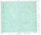
Maps showing Laura Lake, 32S-61-11-W5, Alberta
Laura Lake is a Lake located in 32S-61-11-W5, Alberta and has an elevation of 903 meters.
- Latitude: 54° 18' 51'' North (decimal: 54.3141666)
- Longitude: 115° 36' 44'' West (decimal: -115.6122222)
- Topography Feature Category: Lake
- Geographical Feature: Lake
- Canadian Province/Territory: Alberta
- Elevation: 903 meters
- Location: 32S-61-11-W5
- Atlas of Canada Locator Map: Laura Lake
- GPS Coordinate Locator Map: Laura Lake Lat/Long
Laura Lake NTS Map Sheets