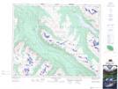
Maps showing Leach Lake, 43-27-W5, Alberta
Leach Lake is a Lake located in 43-27-W5, Alberta and has an elevation of 1248 meters.
- Latitude: 52° 41' 38'' North (decimal: 52.6938888)
- Longitude: 117° 54' 17'' West (decimal: -117.9047222)
- Topography Feature Category: Lake
- Geographical Feature: Lake
- Canadian Province/Territory: Alberta
- Elevation: 1248 meters
- Location: 43-27-W5
- Atlas of Canada Locator Map: Leach Lake
- GPS Coordinate Locator Map: Leach Lake Lat/Long
Leach Lake NTS Map Sheets