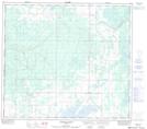
Maps showing Leddy, 11-85-23-W5, Alberta
Leddy is a Unincorporated area located in 11-85-23-W5, Alberta.
- Latitude: 56° 21' 51'' North (decimal: 56.3641666)
- Longitude: 117° 31' 19'' West (decimal: -117.5219444)
- Topography Feature Category: Unincorporated area
- Geographical Feature: Locality
- Canadian Province/Territory: Alberta
- Location: 11-85-23-W5
- Atlas of Canada Locator Map: Leddy
- GPS Coordinate Locator Map: Leddy Lat/Long
Leddy NTS Map Sheets