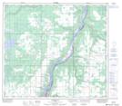
Maps showing Leddy Lake, 85-22-W5, Alberta
Leddy Lake is a Lake located in 85-22-W5, Alberta and has an elevation of 638 meters.
- Latitude: 56° 23' 49'' North (decimal: 56.3969444)
- Longitude: 117° 27' 30'' West (decimal: -117.4583333)
- Topography Feature Category: Lake
- Geographical Feature: Lake
- Canadian Province/Territory: Alberta
- Elevation: 638 meters
- Location: 85-22-W5
- Atlas of Canada Locator Map: Leddy Lake
- GPS Coordinate Locator Map: Leddy Lake Lat/Long
Leddy Lake NTS Map Sheets