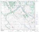
Maps showing Leighton, 15-53-1-W4, Alberta
Leighton is a Unincorporated area located in 15-53-1-W4, Alberta.
- Latitude: 53° 34' North (decimal: 53.5666999)
- Longitude: 110° 5' West (decimal: -110.0832999)
- Topography Feature Category: Unincorporated area
- Geographical Feature: Post Office
- Canadian Province/Territory: Alberta
- Location: 15-53-1-W4
- GPS Coordinate Locator Map: Leighton Lat/Long