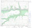
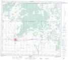
Maps showing Leith (Little Burnt) River, 7-80-1-W6, Alberta
Leith (Little Burnt) River is a River located in 7-80-1-W6, Alberta and has an elevation of 599 meters.
- Latitude: 55° 55' 7'' North (decimal: 55.9186111)
- Longitude: 118° 9' 5'' West (decimal: -118.1513888)
- Topography Feature Category: River
- Geographical Feature: River
- Canadian Province/Territory: Alberta
- Elevation: 599 meters
- Location: 7-80-1-W6
- Atlas of Canada Locator Map: Leith (Little Burnt) River
- GPS Coordinate Locator Map: Leith (Little Burnt) River Lat/Long
Leith (Little Burnt) River NTS Map Sheets