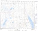
Maps showing Leo, 34-35-17-W4, Alberta
Leo is a Unincorporated area located in 34-35-17-W4, Alberta and has an elevation of 834 meters.
- Latitude: 52° 3' 17'' North (decimal: 52.0547222)
- Longitude: 112° 21' 31'' West (decimal: -112.3586110)
- Topography Feature Category: Unincorporated area
- Geographical Feature: Locality
- Canadian Province/Territory: Alberta
- Elevation: 834 meters
- Location: 34-35-17-W4
- Atlas of Canada Locator Map: Leo
- GPS Coordinate Locator Map: Leo Lat/Long