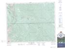
Maps showing Bankfoot Creek, 31-10-W5, Alberta
Bankfoot Creek is a River located in 31-10-W5, Alberta.
- Latitude: 51° 39' 42'' North (decimal: 51.6616667)
- Longitude: 115° 18' 31'' West (decimal: -115.3086110)
- Topography Feature Category: River
- Geographical Feature: Creek
- Canadian Province/Territory: Alberta
- Location: 31-10-W5
- Atlas of Canada Locator Map: Bankfoot Creek
- GPS Coordinate Locator Map: Bankfoot Creek Lat/Long
Bankfoot Creek NTS Map Sheets