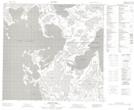
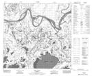
Maps showing Baril Lake, 112,113-10,11-W4, Alberta
Baril Lake is a Lake located in 112,113-10,11-W4, Alberta and has an elevation of 214 meters.
- Latitude: 58° 45' 55'' North (decimal: 58.7652777)
- Longitude: 111° 41' 8'' West (decimal: -111.6855555)
- Topography Feature Category: Lake
- Geographical Feature: Lake
- Canadian Province/Territory: Alberta
- Elevation: 214 meters
- Location: 112,113-10,11-W4
- Atlas of Canada Locator Map: Baril Lake
- GPS Coordinate Locator Map: Baril Lake Lat/Long
Baril Lake NTS Map Sheets