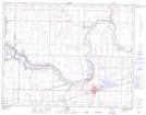
Maps showing Barnwell, 28-9-17-W4, Alberta
Barnwell is a Village located in 28-9-17-W4, Alberta and has an elevation of 832 meters.
- Latitude: 49° 45' 38'' North (decimal: 49.7605555)
- Longitude: 112° 15' 48'' West (decimal: -112.2633333)
- Topography Feature Category: Village
- Geographical Feature: Village
- Canadian Province/Territory: Alberta
- Elevation: 832 meters
- Location: 28-9-17-W4
- Atlas of Canada Locator Map: Barnwell
- GPS Coordinate Locator Map: Barnwell Lat/Long