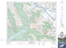
Maps showing Ernest Peak, 34-22-W5, Alberta
Ernest Peak is a Mountain located in 34-22-W5, Alberta and has an elevation of 3246 meters.
- Latitude: 51° 57' 26'' North (decimal: 51.9572222)
- Longitude: 117° 6' 14'' West (decimal: -117.1038889)
- Topography Feature Category: Mountain
- Geographical Feature: Peak
- Canadian Province/Territory: Alberta
- Elevation: 3246 meters
- Location: 34-22-W5
- Atlas of Canada Locator Map: Ernest Peak
- GPS Coordinate Locator Map: Ernest Peak Lat/Long
Ernest Peak NTS Map Sheets