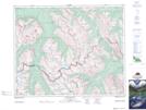
Maps showing Escarpment River, 33-17-W5, Alberta
Escarpment River is a River located in 33-17-W5, Alberta and has an elevation of 2041 meters.
- Latitude: 51° 55' 43'' North (decimal: 51.9286111)
- Longitude: 116° 21' 15'' West (decimal: -116.3541666)
- Topography Feature Category: River
- Geographical Feature: River
- Canadian Province/Territory: Alberta
- Elevation: 2041 meters
- Location: 33-17-W5
- Atlas of Canada Locator Map: Escarpment River
- GPS Coordinate Locator Map: Escarpment River Lat/Long
Escarpment River NTS Map Sheets