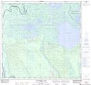
Maps showing Ess Bend, 109-7-W4, Alberta
Ess Bend is a River feature located in 109-7-W4, Alberta and has an elevation of 231 meters.
- Latitude: 58° 27' 23'' North (decimal: 58.4563888)
- Longitude: 111° 8' 14'' West (decimal: -111.1372221)
- Topography Feature Category: River feature
- Geographical Feature: Bend
- Canadian Province/Territory: Alberta
- Elevation: 231 meters
- Location: 109-7-W4
- Atlas of Canada Locator Map: Ess Bend
- GPS Coordinate Locator Map: Ess Bend Lat/Long
Ess Bend NTS Map Sheets