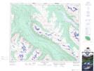
Maps showing Evelyn Pass, Alberta
Evelyn Pass is a Valley located in Alberta.
- Latitude: 52° 42' North (decimal: 52.7000000)
- Longitude: 117° 46' West (decimal: -117.7666999)
- Topography Feature Category: Valley
- Geographical Feature: Pass
- Canadian Province/Territory: Alberta
- Atlas of Canada Locator Map: Evelyn Pass
- GPS Coordinate Locator Map: Evelyn Pass Lat/Long
Evelyn Pass NTS Map Sheets