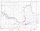
Maps showing Expanse Coulee, 12-16-W4, Alberta
Expanse Coulee is a Valley located in 12-16-W4, Alberta and has an elevation of 778 meters.
- Latitude: 49° 57' 39'' North (decimal: 49.9607779)
- Longitude: 112° 3' 1'' West (decimal: -112.0502220)
- Topography Feature Category: Valley
- Geographical Feature: Coulee
- Canadian Province/Territory: Alberta
- Elevation: 778 meters
- Location: 12-16-W4
- Atlas of Canada Locator Map: Expanse Coulee
- GPS Coordinate Locator Map: Expanse Coulee Lat/Long
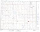
Expanse Coulee NTS Map Sheets