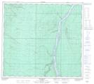
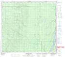
Maps showing Eymundson Creek, 98-10-W4, Alberta
Eymundson Creek is a River located in 98-10-W4, Alberta and has an elevation of 317 meters.
- Latitude: 57° 29' 30'' North (decimal: 57.4916666)
- Longitude: 111° 34' 5'' West (decimal: -111.5680556)
- Topography Feature Category: River
- Geographical Feature: Creek
- Canadian Province/Territory: Alberta
- Elevation: 317 meters
- Location: 98-10-W4
- Atlas of Canada Locator Map: Eymundson Creek
- GPS Coordinate Locator Map: Eymundson Creek Lat/Long
Eymundson Creek NTS Map Sheets