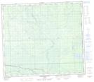
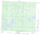
Maps showing Fawcett Lake, 73-26-W4, Alberta
Fawcett Lake is a Lake located in 73-26-W4, Alberta and has an elevation of 632 meters.
- Latitude: 55° 18' 42'' North (decimal: 55.3116666)
- Longitude: 113° 55' 0'' West (decimal: -113.9166667)
- Topography Feature Category: Lake
- Geographical Feature: Lake
- Canadian Province/Territory: Alberta
- Elevation: 632 meters
- Location: 73-26-W4
- Atlas of Canada Locator Map: Fawcett Lake
- GPS Coordinate Locator Map: Fawcett Lake Lat/Long
Fawcett Lake NTS Map Sheets