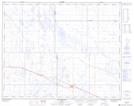
Maps showing Dobson, 20-29-8-W4, Alberta
Dobson is a Unincorporated area located in 20-29-8-W4, Alberta.
- Latitude: 51° 30' North (decimal: 51.4999999)
- Longitude: 111° 6' West (decimal: -111.1000000)
- Topography Feature Category: Unincorporated area
- Geographical Feature: Station
- Canadian Province/Territory: Alberta
- Location: 20-29-8-W4
- GPS Coordinate Locator Map: Dobson Lat/Long
Dobson NTS Map Sheets