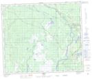
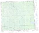
Maps showing Lesser Slave River, 71-1-W5, Alberta
Lesser Slave River is a River located in 71-1-W5, Alberta and has an elevation of 579 meters.
- Latitude: 55° 9' 59'' North (decimal: 55.1663888)
- Longitude: 114° 3' 31'' West (decimal: -114.0586110)
- Topography Feature Category: River
- Geographical Feature: River
- Canadian Province/Territory: Alberta
- Elevation: 579 meters
- Location: 71-1-W5
- Atlas of Canada Locator Map: Lesser Slave River
- GPS Coordinate Locator Map: Lesser Slave River Lat/Long
Lesser Slave River NTS Map Sheets