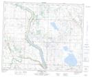
Maps showing Levering Lake, 48-22-W4, Alberta
Levering Lake is a Lake located in 48-22-W4, Alberta and has an elevation of 770 meters.
- Latitude: 53° 14' 13'' North (decimal: 53.2369443)
- Longitude: 113° 9' 25'' West (decimal: -113.1569443)
- Topography Feature Category: Lake
- Geographical Feature: Lake
- Canadian Province/Territory: Alberta
- Elevation: 770 meters
- Location: 48-22-W4
- Atlas of Canada Locator Map: Levering Lake
- GPS Coordinate Locator Map: Levering Lake Lat/Long
Levering Lake NTS Map Sheets