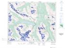
Maps showing Lick Peak, 40-28-W5, Alberta
Lick Peak is a Mountain located in 40-28-W5, Alberta and has an elevation of 2453 meters.
- Latitude: 52° 26' 48'' North (decimal: 52.4466666)
- Longitude: 117° 54' 57'' West (decimal: -117.9158333)
- Topography Feature Category: Mountain
- Geographical Feature: Peak
- Canadian Province/Territory: Alberta
- Elevation: 2453 meters
- Location: 40-28-W5
- Atlas of Canada Locator Map: Lick Peak
- GPS Coordinate Locator Map: Lick Peak Lat/Long
Lick Peak NTS Map Sheets