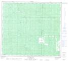
Maps showing Lightning Creek, 34-87-2-W6, Alberta
Lightning Creek is a River located in 34-87-2-W6, Alberta.
- Latitude: 56° 34' 50'' North (decimal: 56.5805555)
- Longitude: 118° 13' 39'' West (decimal: -118.2274999)
- Topography Feature Category: River
- Geographical Feature: Creek
- Canadian Province/Territory: Alberta
- Location: 34-87-2-W6
- Atlas of Canada Locator Map: Lightning Creek
- GPS Coordinate Locator Map: Lightning Creek Lat/Long
Lightning Creek NTS Map Sheets