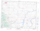
Maps showing Lime Kiln Lake, 28-5-3-W4, Alberta
Lime Kiln Lake is a Lake located in 28-5-3-W4, Alberta.
- Latitude: 49° 25' 13'' North (decimal: 49.4202778)
- Longitude: 113° 59' 31'' West (decimal: -113.9919444)
- Topography Feature Category: Lake
- Geographical Feature: Lake
- Canadian Province/Territory: Alberta
- Location: 28-5-3-W4
- Atlas of Canada Locator Map: Lime Kiln Lake
- GPS Coordinate Locator Map: Lime Kiln Lake Lat/Long
Lime Kiln Lake NTS Map Sheets