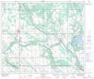
Maps showing Lindbergh, 34-56-5-W4, Alberta
Lindbergh is a Unincorporated area located in 34-56-5-W4, Alberta and has an elevation of 537 meters.
- Latitude: 53° 53' 15'' North (decimal: 53.8875000)
- Longitude: 110° 40' 22'' West (decimal: -110.6727778)
- Topography Feature Category: Unincorporated area
- Geographical Feature: Hamlet
- Canadian Province/Territory: Alberta
- Elevation: 537 meters
- Location: 34-56-5-W4
- Atlas of Canada Locator Map: Lindbergh
- GPS Coordinate Locator Map: Lindbergh Lat/Long
Lindbergh NTS Map Sheets