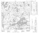
Maps showing Lister Lake, 123-1-W4, Alberta
Lister Lake is a Lake located in 123-1-W4, Alberta and has an elevation of 326 meters.
- Latitude: 59° 42' 44'' North (decimal: 59.7122222)
- Longitude: 110° 9' 20'' West (decimal: -110.1555555)
- Topography Feature Category: Lake
- Geographical Feature: Lake
- Canadian Province/Territory: Alberta
- Elevation: 326 meters
- Location: 123-1-W4
- Atlas of Canada Locator Map: Lister Lake
- GPS Coordinate Locator Map: Lister Lake Lat/Long
Lister Lake NTS Map Sheets