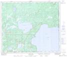
Maps showing Little Bear Lake, 19-64-2-W4, Alberta
Little Bear Lake is a Lake located in 19-64-2-W4, Alberta and has an elevation of 550 meters.
- Latitude: 54° 33' 7'' North (decimal: 54.5519444)
- Longitude: 110° 17' 52'' West (decimal: -110.2977777)
- Topography Feature Category: Lake
- Geographical Feature: Lake
- Canadian Province/Territory: Alberta
- Elevation: 550 meters
- Location: 19-64-2-W4
- Atlas of Canada Locator Map: Little Bear Lake
- GPS Coordinate Locator Map: Little Bear Lake Lat/Long
Little Bear Lake NTS Map Sheets