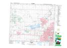
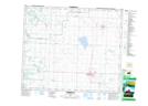
Maps showing Little Egg Creek, 55-24-W4, Alberta
Little Egg Creek is a River located in 55-24-W4, Alberta and has an elevation of 679 meters.
- Latitude: 53° 44' North (decimal: 53.7333000)
- Longitude: 113° 31' West (decimal: -113.5166999)
- Topography Feature Category: River
- Geographical Feature: Creek
- Canadian Province/Territory: Alberta
- Elevation: 679 meters
- Location: 55-24-W4
- Atlas of Canada Locator Map: Little Egg Creek
- GPS Coordinate Locator Map: Little Egg Creek Lat/Long
Little Egg Creek NTS Map Sheets