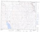
Maps showing Little Fox Hill, 20-19-W4, Alberta
Little Fox Hill is a Mountain located in 20-19-W4, Alberta and has an elevation of 840 meters.
- Latitude: 50° 43' 21'' North (decimal: 50.7225000)
- Longitude: 112° 31' 8'' West (decimal: -112.5188889)
- Topography Feature Category: Mountain
- Geographical Feature: Hill
- Canadian Province/Territory: Alberta
- Elevation: 840 meters
- Location: 20-19-W4
- Atlas of Canada Locator Map: Little Fox Hill
- GPS Coordinate Locator Map: Little Fox Hill Lat/Long
Little Fox Hill NTS Map Sheets