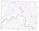
Maps showing Bartstow, 22-23-W4, Alberta
Bartstow is a Unincorporated area located in 22-23-W4, Alberta and has an elevation of 907 meters.
- Latitude: 50° 52' 41'' North (decimal: 50.8780555)
- Longitude: 113° 9' 58'' West (decimal: -113.1661110)
- Topography Feature Category: Unincorporated area
- Geographical Feature: Locality
- Canadian Province/Territory: Alberta
- Elevation: 907 meters
- Location: 22-23-W4
- Atlas of Canada Locator Map: Bartstow
- GPS Coordinate Locator Map: Bartstow Lat/Long