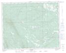
Maps showing Base Line Creek, 37-9-W5, Alberta
Base Line Creek is a River located in 37-9-W5, Alberta and has an elevation of 1369 meters.
- Latitude: 52° 12' 25'' North (decimal: 52.2069444)
- Longitude: 115° 11' 34'' West (decimal: -115.1927777)
- Topography Feature Category: River
- Geographical Feature: Creek
- Canadian Province/Territory: Alberta
- Elevation: 1369 meters
- Location: 37-9-W5
- Atlas of Canada Locator Map: Base Line Creek
- GPS Coordinate Locator Map: Base Line Creek Lat/Long
Base Line Creek NTS Map Sheets